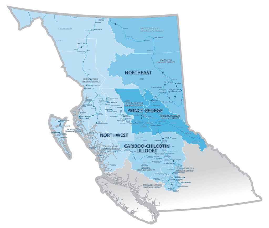
Northern Development’s region covers approximately 70 per cent of the province of British Columbia, Canada. The region encompasses 39 municipalities, nine regional districts, one regional municipality and 89 First Nations communities.
The region is divided into four principal regions (Cariboo-Chilcotin/Lillooet, Northeast, Northwest, and Prince George) as outlined in the Northern Development Initiative Trust Act (2004). Each of the four regions has a Regional Advisory Committee comprised of elected local government leaders that advises Northern Development’s Board of Directors. This ensures that local knowledge is incorporated into Northern Development’s Strategic Plan as well as funding decisions.
For a detailed view of Northern Development’s Region, download the regional map as an 2 mb PDF (right-click the link or below image to Save As PDF).
COMMUNITIES
Municipalities
100 Mile House, Ashcroft, Burns Lake, Cache Creek, Chetwynd, Clinton, Daajing Giids, Dawson Creek, Fort St. James, Fort St. John, Fraser Lake, Granisle, Hazelton, Houston, Hudson’s Hope, Kitimat, Lillooet, Logan Lake, Lytton, Mackenzie, Masset, McBride, New Hazelton, Port Clements, Port Edward, Pouce Coupe, Prince George, Prince Rupert, Quesnel, Smithers, Stewart, Taylor, Telkwa, Terrace, Tumbler Ridge, Valemount, Vanderhoof, Wells, Williams Lake
Regional Districts
Cariboo Regional District, Central Coast Regional District, North Coast Regional District, Peace River Regional District, Regional District of Bulkley-Nechako, Regional District of Fraser-Fort George, Regional District of Kitimat-Stikine, Squamish Lillooet Regional District, Thompson Nicola Regional District
Regional Municipalities
Northern Rockies Regional Municipality